
Skeda:Philippines relief location map (Mindanao).svg

Size of this PNG preview of this SVG file: 656 × 486 pixel. Rezolucione të tjera: 320 × 237 pixel | 640 × 474 pixel | 1.024 × 759 pixel | 1.280 × 948 pixel | 2.560 × 1.897 pixel.
Dokument origjinal (skedë SVG, fillimisht 656 × 486 pixel, madhësia e skedës: 2,21 MB)
.svg)
Përmbledhje
| Përshkrimi |
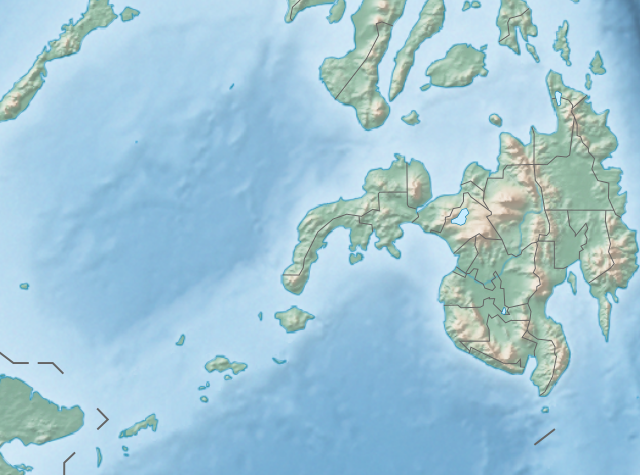
English: Physical location map of the Philippines (Mindanao)
Equirectangular projection based on the parallel of 10°43' N
|
| Data | |
| Burimi | File:Philippines location map (square).svg |
| Autori | User:Hellerick |
| Versione tjera |
This file was derived from: Philippines relief location map (square).svg: .svg) |
.svg)
Licencim
Kjo skedë licencohet sipas Creative Commons Attribution-Share Alike 3.0 Unported.
- Je i lirë të:
- ta shpërndani – ta kopjoni, rishpërndani dhe përcillni punën
- t’i bëni “remix” – të përshtatni punën
- Sipas kushteve të mëposhtme:
- atribuim – Duhet t’i jepni meritat e duhura, të siguroni një lidhje për tek licenca dhe të tregoni nëse janë bërë ndryshime. Këtë mund ta bëni në ndonjë mënyrë të arsyeshme, por jo në ndonjë mënyrë që sugjeron se licencuesi ju del zot juve apo përdorimit tuaj.
- share alike – Nëse bëni një “remix”, e shndërroni, ose ndërtoni duke u bazuar te materiali, duhet t’i shpërndani kontributet tuaja sipas të njëjtës licencë ose një të tille të përputhshme me origjinalen.
Historiku i dosjes
Shtypni një datë/kohë për ta parë skedën ashtu si dukej në atë kohë.
| Data/Ora | Miniaturë | Përmasa | Përdoruesi | Koment | |
|---|---|---|---|---|---|
| e tanishme | 27 tetor 2017 14:36 | | 656 × 486 (2,21 MB) | Mliu92 | Updated crop to add missing island. |
| 26 tetor 2017 17:23 |  | 573 × 573 (2,21 MB) | Mliu92 | User created page with UploadWizard |
Përdorimi i skedës
S’ka faqe që përdorin këtë kartelë.
Përdorimi global i skedës
Kjo skedë përdoret nga Wiki të tjera në vijim:
- Përdorimi në bcl.wikipedia.org
- Përdorimi në bn.wikipedia.org
- Përdorimi në en.wikipedia.org
- Sulu Sea
- Moro Gulf
- Mount Apo
- Davao Gulf
- Iligan Bay
- Panguil Bay
- Bud Dajo
- Mount Butung
- Agusan River
- Lake Lanao
- Rio Grande de Mindanao
- Butuan Bay
- Mount Agad-Agad
- Mount Hibok-Hibok
- Mount Makaturing
- Mount Matutum
- Musuan Peak
- Agus River
- Sibuguey Bay
- Illana Bay
- Mount Sumagaya
- Dinagat Island
- Davao River
- Leonard Kniaseff
- Mount Kitanglad
- Macajalar Bay
- Pulangi River
- Cagayan River (Mindanao)
- Mount Dulang-dulang
- Tagoloan River
- Lake Buluan
- Lake Wood (Philippines)
- Lake Dapao
- Mount Malindang
- Mount Kalatungan
- Latukan
- Mount Balatukan
- Mount Hamiguitan
- Mount Baya
- Agusan Marsh Wildlife Sanctuary
- Camp General Basilio Navarro
- 2010 Mindanao earthquakes
- Manupali River
Shikoni më shumë përdorim global të kësaj skede.
.svg)
.svg)